Search Log in Basket
Lake Pulse Toolbox  |  SKU: LP-BH-BAAS-001

Bathymetry Survey

$5.00
Shipping calculated at checkout.


Description

Lake Pulse makes bathymetric surveys easy, accurate, and entirely hands-off. With Bathymetry-as-a-Service, a trained Lake Pulse 3rd party operator brings an autonomous marine drone to your lake to complete a full depth survey—no special equipment or on-site coordination required. Just provide access instructions and we’ll handle the rest.

*** Why does this say it costs $5?    To ensure this drone-based bathymetry survey delivers exactly what you need, we require a brief scoping call before scheduling. This call is set at a nominal $5 fee — not as a cost, but as a signal of commitment and to save you both time and money in the long run. Conducting a bathymetry survey on your lake involves important upfront considerations: 1) Lake navigational parameters, 2) Mission size and scope. 3) Specific objectives and data requirements. A short alignment call allows us to clarify these details upfront, streamline the planning process, and avoid unnecessary costs or delays.

What problem does this solve?

Why you might need this:

  • You need a baseline depth map to guide dredging, restoration, or muck volume assessments.
  • Manual or boat-based surveys are too costly, time-consuming, or hard to access in parts of your lake.
  • You suspect sediment buildup or changes in lake volume but lack precise measurements.
  • You want to track depth and sedimentation changes over time to inform future interventions.
  • You need accurate data for internal loading models or to identify critical aquatic habitat zones.

What's included?

What's included

On-Site Expert Deployment: A Lake Pulse technician will travel to your lake and operate the vessel from start to finish.

Autonomous Marine Drone: Our partner's compact, 1-meter survey vessel uses advanced dual GNSS + IMU sensors to follow precise routes—even in strong currents or shallow water.

Single-Beam Echosounder: High-resolution sonar (±0.01 m accuracy) measures lake depth at a range of 0.15 to 200 meters.

Shallow-Draft Performance: With just a 10 cm draft, it can safely operate in tight, shallow zones that traditional boats can’t reach.

Durable & Portable Hardware: Built with Kevlar-reinforced carbon fiber, the system performs reliably in rugged field conditions with minimal footprint.

Results

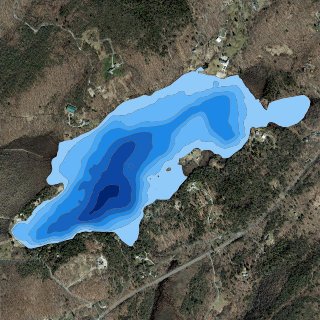
Detailed Bathymetric Maps: Accurate lakebed profiles to guide dredging, volume calculations, and sediment assessments.

Efficient Survey Turnaround: Faster, safer, and more cost-effective than traditional boat-based surveys, especially in hard-to-reach areas.

Baseline for Long-Term Monitoring: Establish a depth reference point for tracking sedimentation and lakebed changes over time.

Better Planning Tools: Support infrastructure, ecological, or remediation planning with high-resolution depth and volume data.

Increased Operational Efficiency: Reduce labor and equipment needs while improving the quality and consistency of depth measurements.


Payment & Security

Payment methods

  • American Express
  • Apple Pay
  • Diners Club
  • Discover
  • Google Pay
  • Mastercard
  • PayPal
  • Shop Pay
  • Venmo
  • Visa

Your payment information is processed securely. We do not store credit card details nor have access to your credit card information.

Telehealth for Lakes

Lake Pulse understands you are tired of waiting for others to produce data on your lake. The Toolbox enables you generate the data you need to reach your lake health & safety goals.